Time Sync Solutions
Crucial Mission of Sensor Fusion – Time Sync Technology
Autonomous vehicles and robotics have become a growing trend in various industries, including construction, agriculture, mining, and heavy machinery robotics. These machines are designed to operate independently without human intervention, which can help increase efficiency, reduce labor costs, and improve safety. Time synchronization technologies can help improve sensor synchronization by providing more accurate and detailed information about the environment. According to a report by MarketsandMarkets, the outdoor robotics market is projected to grow at a CAGR of 27.4% during the forecast period from 2021 to 2026, driven by the increasing demand for automation, advancements in sensor technologies, and the growing adoption of UAVs.
We understand the challenges associated with multi-sensor synchronization and focuses on five key areas to address these challenges: Mapping, Sensor Fusion, Localization, Navigation, and Calibration are indeed critical areas for ensuring accurate and reliable operation of autonomous vehicles and robotics. Using a combination of 3D LiDARs, cameras, IMU, GNSS, and Radar sensors to create a 3D point cloud of the environment is a common approach in the industry. Combining the data from these sensors into a single, comprehensive model of the environment through sensor fusion algorithms is also critical for tasks such as mapping, localization, obstacle detection, path planning, and more. Calibration is equally important to ensure that the data from each sensor is accurately synchronized and aligned, leading to reliable and precise operation of autonomous systems.
The solution offers three key technologies for time synchronization: Time Winding, Time Stamping, and Time Keeping. These technologies will improve multi-sensor synchronization, perception, precision, and positioning capabilities. The solution also provides a multi-channel Time of Day (ToD) and Pulse Per Second (PPS) output for external multi-sensors, a PTP/gPTP Gigabit Ethernet port, and one Gigabit Ethernet port for ROS 2/DDS pub/sub output. It includes a dual GNSS antenna for robot heading and integrates Xsens MTi-670 high-precision 9-axis IMU. The software features include a daisy chain function that enables the expansion of synchronization channels for sensor nodes and controllers. The solution has already integrated the dual GNSS antenna and IMU yaw fusion algorithm and provides reliable information output through the Ethernet port. We also offer a user-friendly Python tool for easy configuration of synchronization protocols and frequency based on sensor requirements. The platform is based on Xilinx's Zynq UltraScale+ MPSoC, known for its high accuracy and reliability in synchronizing time-sensitive data across industrial networks.
Time Winding
-
Align GNSS with sensor internal clock
-
Continuous PPS trigger to all nodes
-
Guarantee all sensor as same baseline
Time Stamping
-
Push time protocol to all nodes
-
Ensure all sensors are synced
-
Supports various frequency
-
Sensor node to sensor node sync
-
Controller to Controller sync
-
Auto calibration of latency
-
Expand the sync channels
Vecow Time Synchronization Technology – Mobile Mapping Kit is a user-friendly solution designed to enable devices to simultaneously self-locate and create maps of its surrounding environment. Time sync plays a key role in achieving high-quality map creation, as it ensures that all sensor data is correctly aligned in the temporal domain. This alignment is essential for accurately associating sensor measurements with corresponding landmarks or features in the environment, then reducing data processing errors. Time sync contributes to precise motion estimation and loop closure detection, resulting in more accurate, reliable, and high-quality mapping results through SLAM. The kit includes Vecow VCM-1000F controller and Kudan SLAM software, making it suitable for various environments.
Vecow Time Synchronization Solution – The intrinsic and extrinsic calibration of multiple sensors (such as cameras, lidars, radars, IMUs) is a crucial algorithm for achieving safe and reliable autonomous system operation indoors or outdoors. Traditional methods of calibration are time-consuming, costly, and prone to errors due to manual steps. Our partner Curium offers fully automated multi-sensor calibration solution for automotive and non-automotive use cases. Automated calibration enables faster and more frequent calibration cycles, with a time sync feature that improves the sensor fusion and stability over time. Curium Calibration Edge (C2E) comprises Vecow's ECX-3200 controller running Curium Calibration Suite (C2S) for seam-less and hassle-free dynamic calibration on-the-go.
Multi-sensor fusion is a critical software algorithm in outdoor robotics and autonomous vehicle applications. The accuracy of the fused data directly affects the navigation quality and safety capabilities of the system. To further enhance the integration capabilities of our controller, we collaborate with a software partner specializing in sensor fusion and software stack development. By combining our robust controller with their advanced software expertise, we ensure that our customers receive high-quality sensor fusion and perception capabilities.
To achieve localization, the process involves collecting data from multiple sensors and utilizing reliable maps, sensors such as LiDAR, GNSS, IMU, cameras, and wheel odometry data are used in combination. In collaboration with our localization software partner, we provide advanced localization solutions that offer high precision and accuracy.
The robot's ability to determine its own position and plan a path toward a goal location involves various technologies such as visual positioning, LiDAR-based positioning, GNSS-based positioning, sensor fusion, global path planning, local path planning, waypoint-based navigation, teach-repeat navigation, and obstacle avoidance. Vecow offers a comprehensive range of controllers that cater to the diverse needs of our customers. Through our collaborative approach with software partners, we not only address concerns regarding hardware reliability but also enable our customers to achieve optimal performance in their applications.
To learn more about Vecow Time Sync Solutions, please contact [email protected] for more details.
Time Sync Box
 |
 |
 |
|
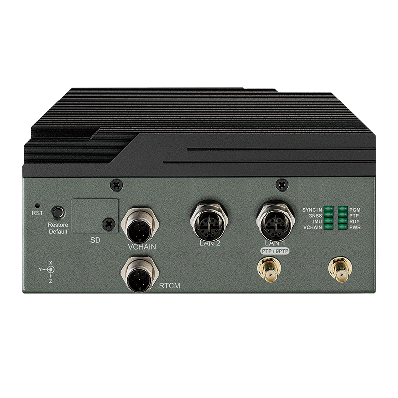
VTS-1200GU
Xillinx Zynq® UltraScale+™ MPSoC
1 Sync In, 8 Sync Out, 1 RTCM, 1 UART, Dual GNSS GPS, 9-axis IMU
|
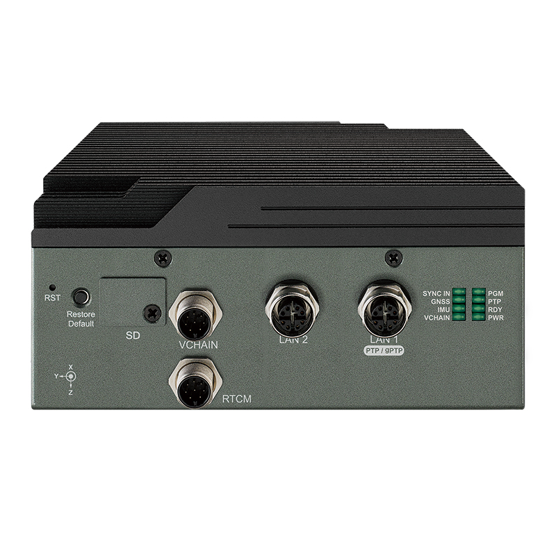
VTS-1200
Xillinx Zynq® UltraScale+™ MPSoC
2 1 Sync In, 8 Sync Out, 1 RTCM, 1 UART
|
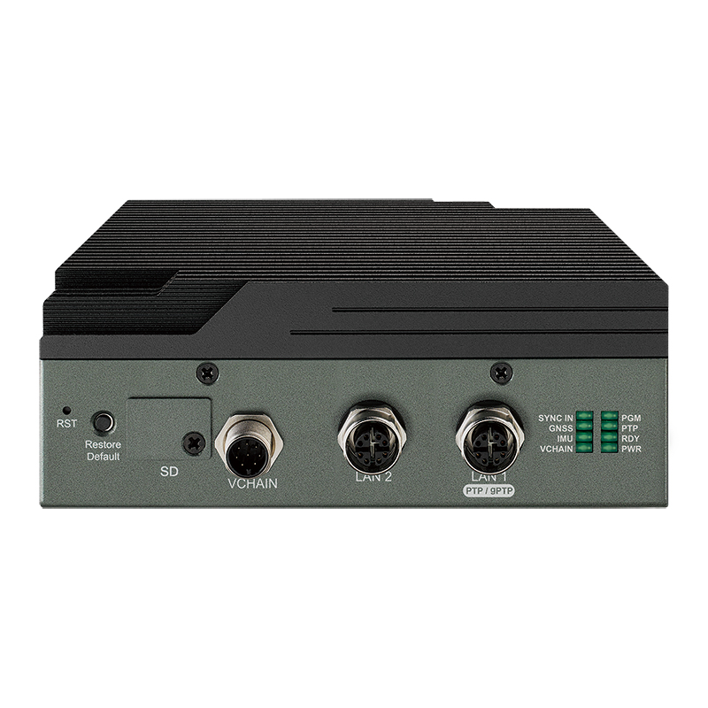
VTS-1100
Xillinx Zynq® UltraScale+™ MPSoC
2 1 Sync In, 5 Sync Out
|